
S2C USBL Buoy
Fully integrated positioning solution.
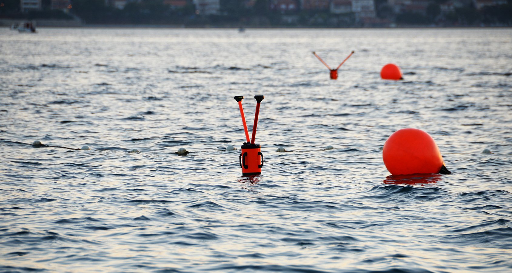
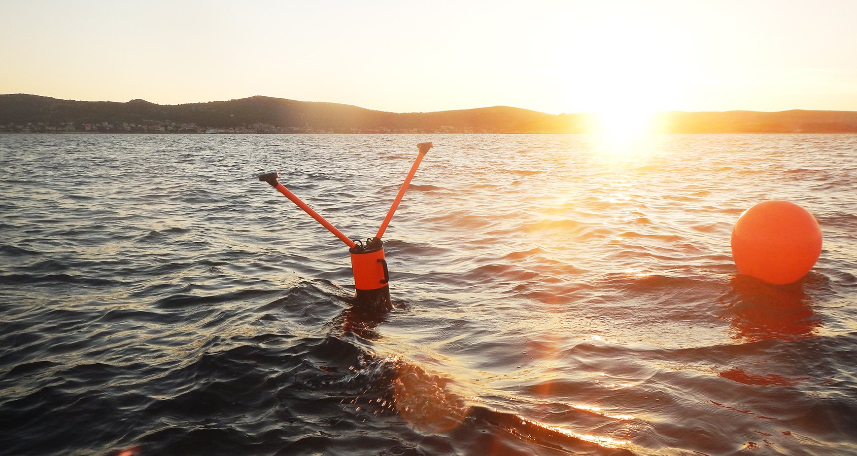
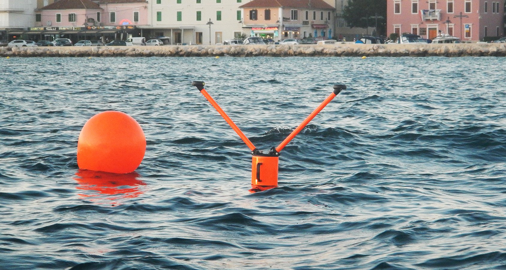
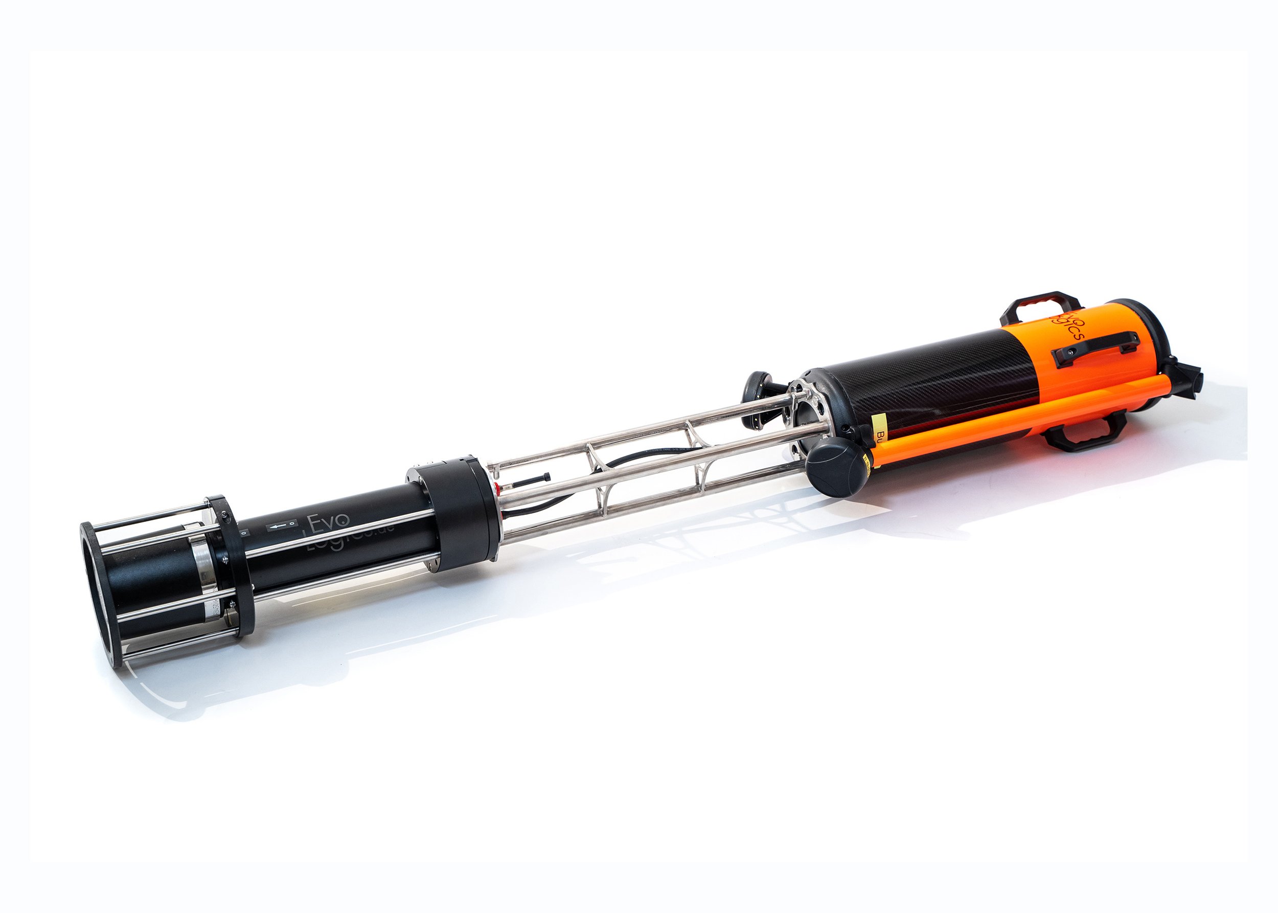
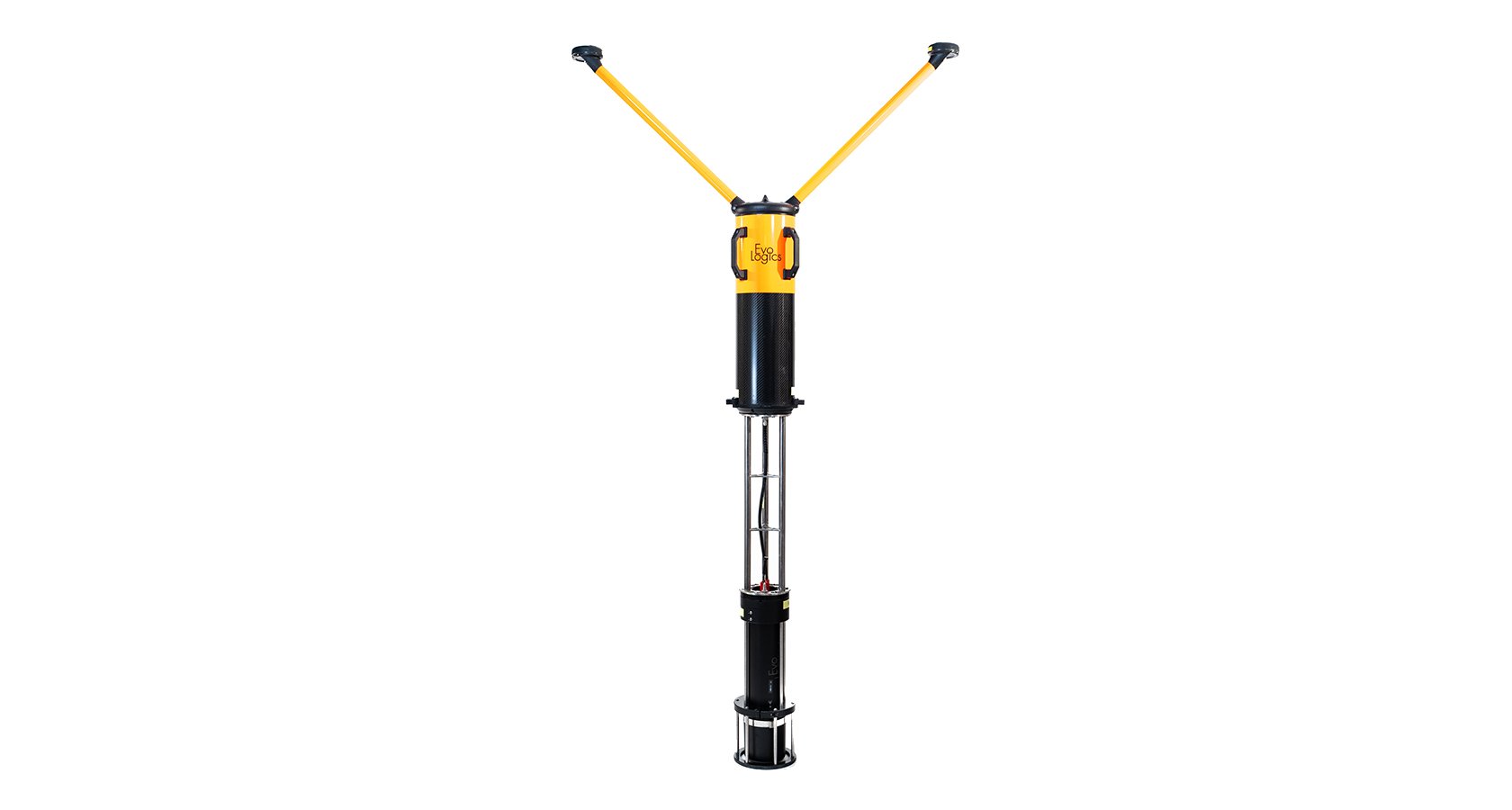
The USBL buoy is a fully integrated solution. It comprises a USBL transceiver with a built-in battery, mounted to a floating unit with an on-board PC, GNSS receiver with dual antennas, and a Wi-Fi access point.
Positioning, navigation and communication for unmanned underwater vehicles
Diver tracking
Survey
Mapping
Connect several buoys in series for seamless coverage over large areas
Autonomous search
Buoy configuration is available for all S2C USBL-series devices
Applications include
Positioning, navigation and communication for unmanned underwater vehicles
Diver tracking
Underwater acoustic sensor networks
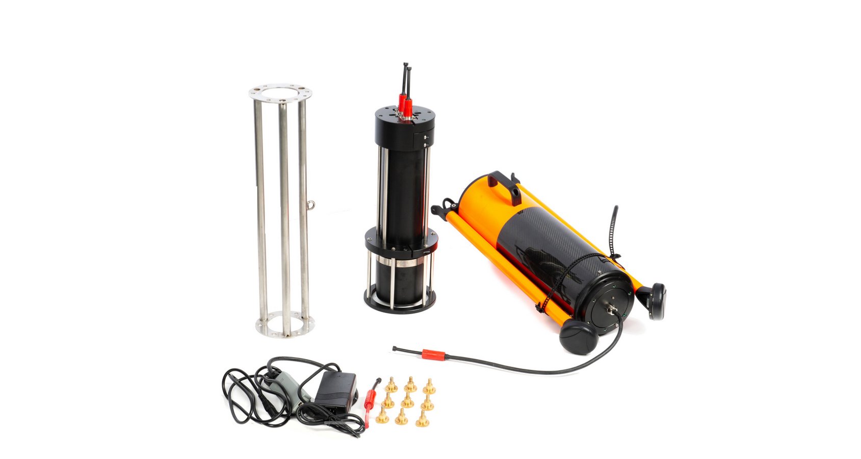
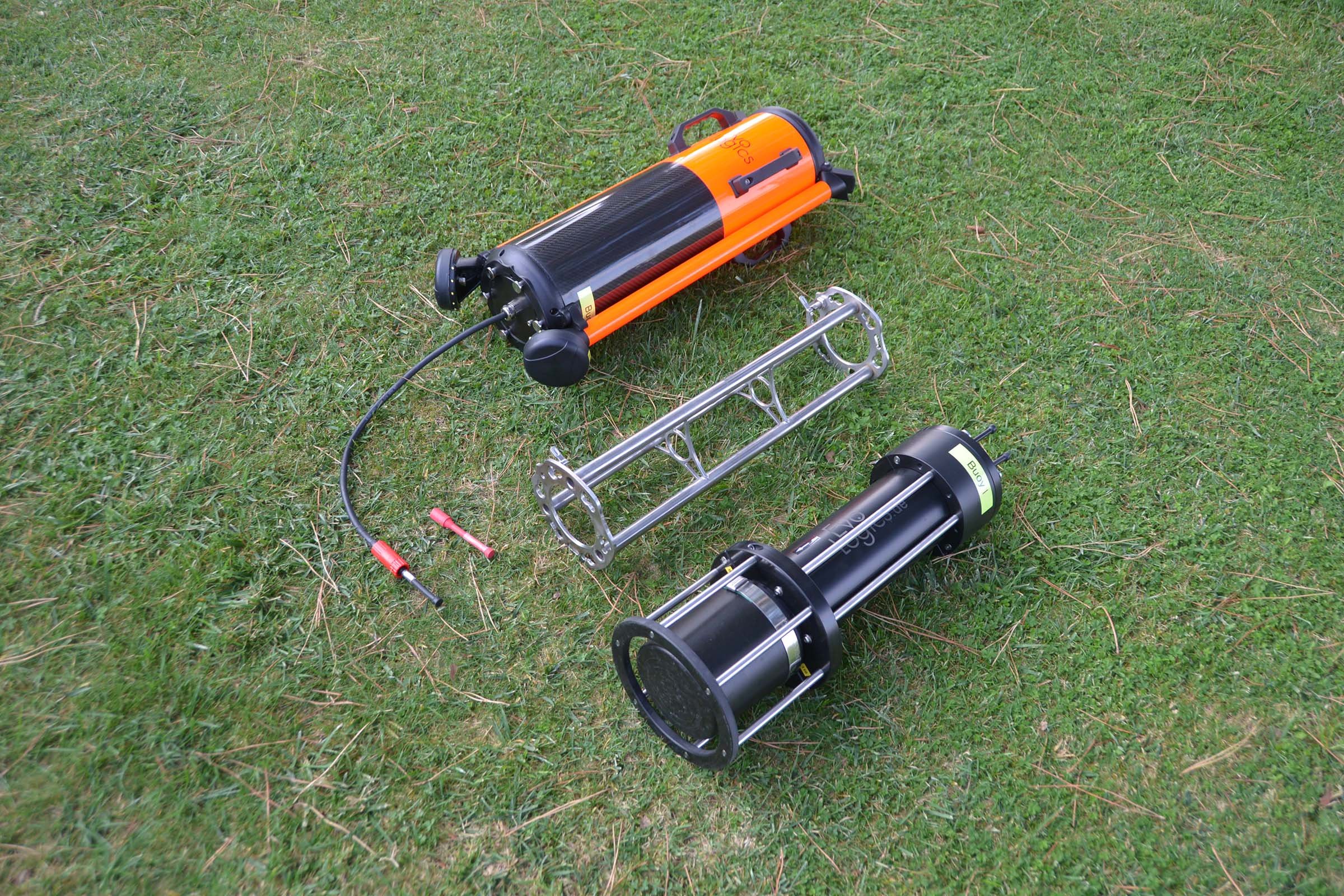
The USBL buoy is a fully integrated deployment-ready unit. All system components are pre-configured, calibrated and ready-to-go:
USBL transceiver with a built-in battery, mounted to a floating unit with on-board PC, dual-antenna GNSS receiver and Wi-Fi access point
On-board PC runs pre-installed SiNAPS, the EvoLogics positioning software
USBL data and control over Wi-Fi
NMEA data stream for custom processing
Light and compact no-foam buoyancy
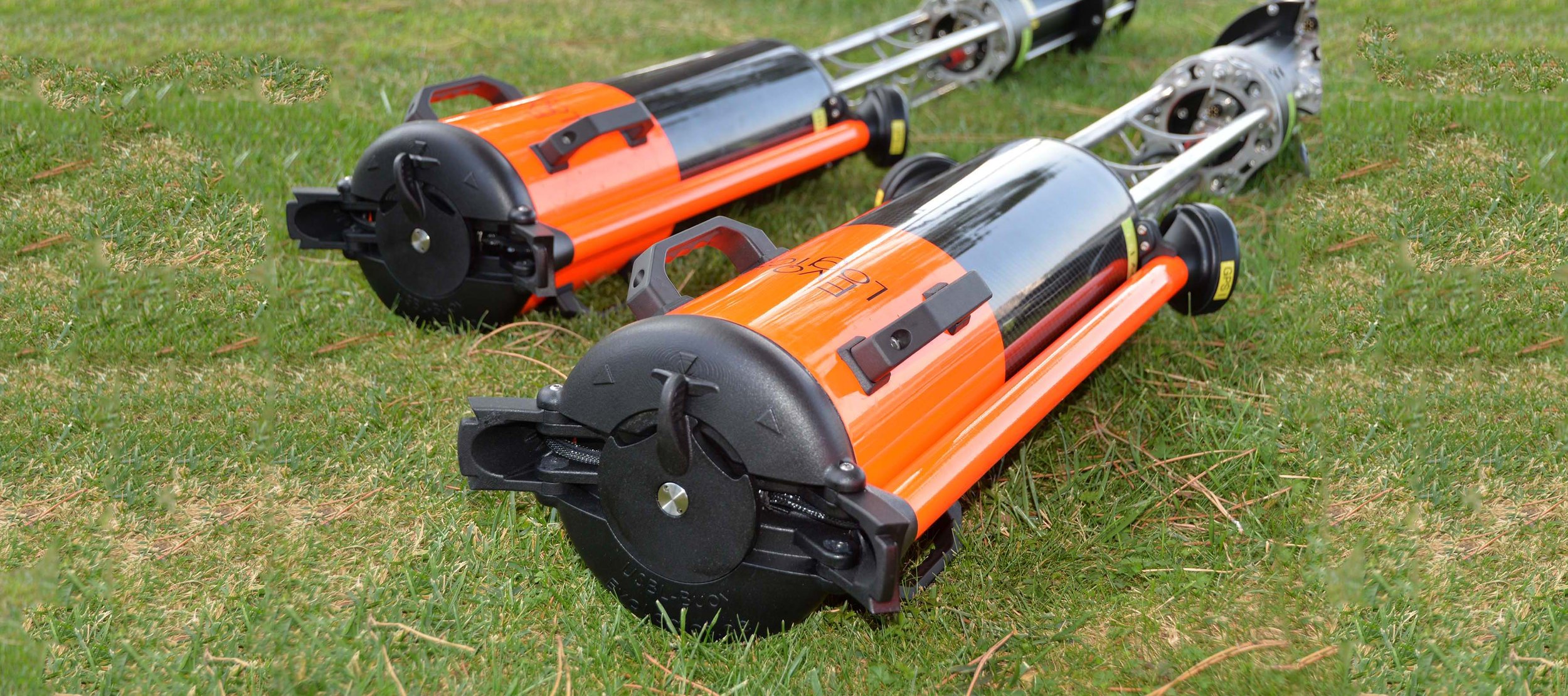
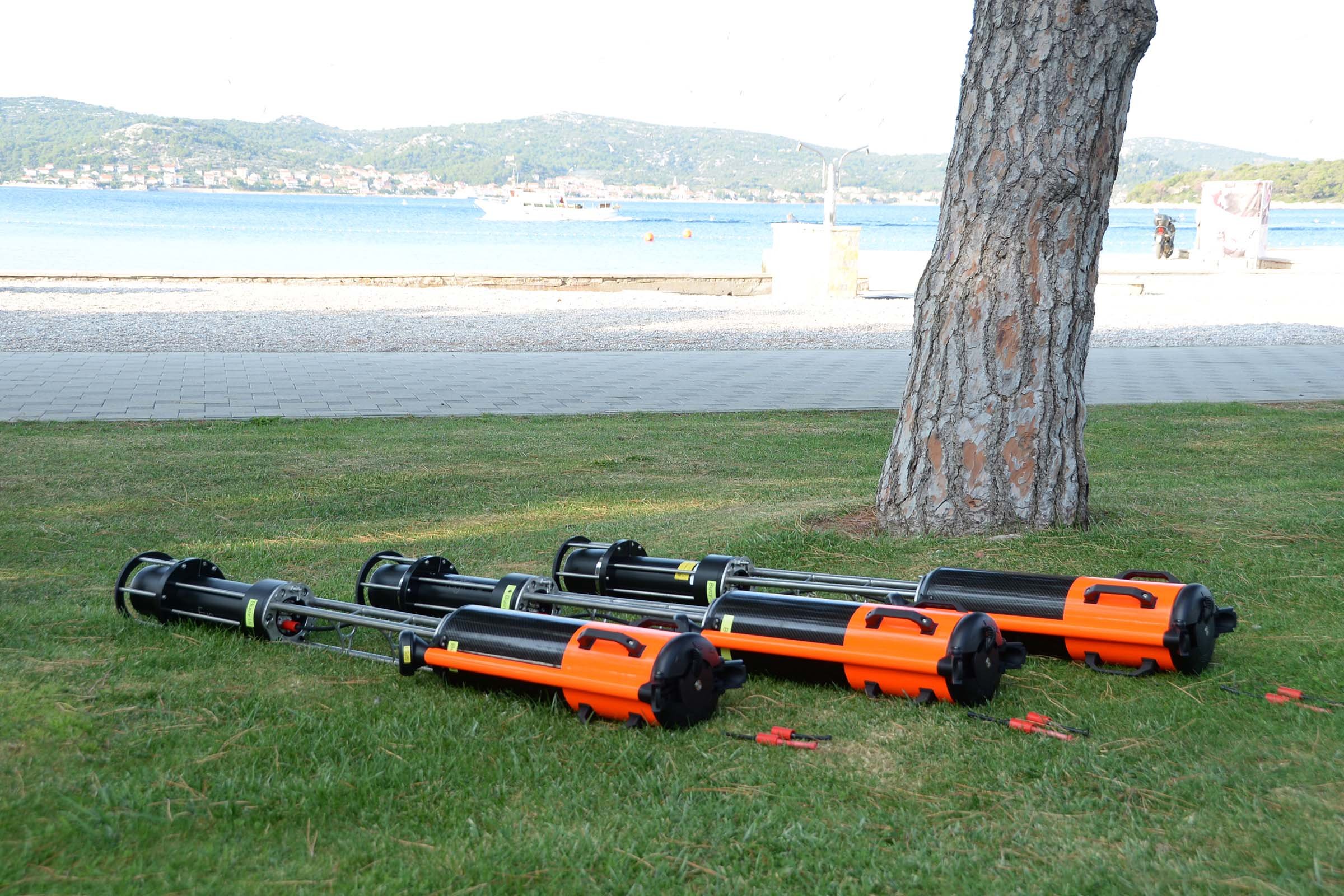
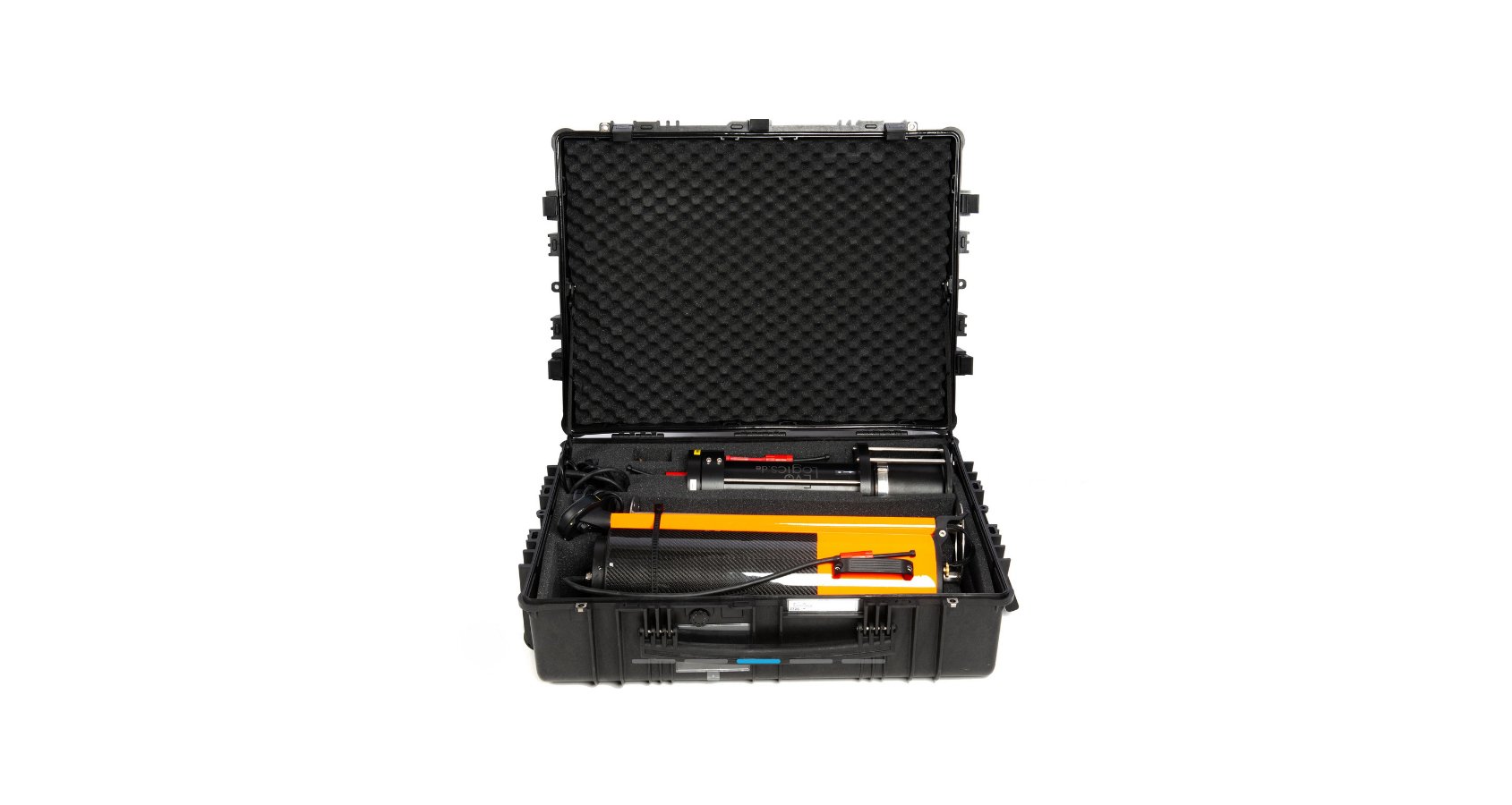
Packs up into a single case and can be easily transported, assembled and deployed by a single operator
Acts as a surface-based node for an underwater network, provides high-precision geo-referenced positioning for the underwater nodes, can create an own mobile network or flexibly extend an existing network
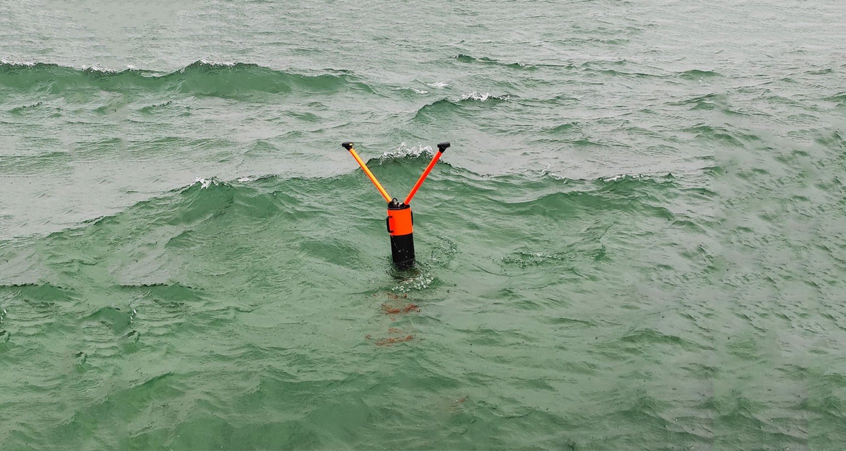


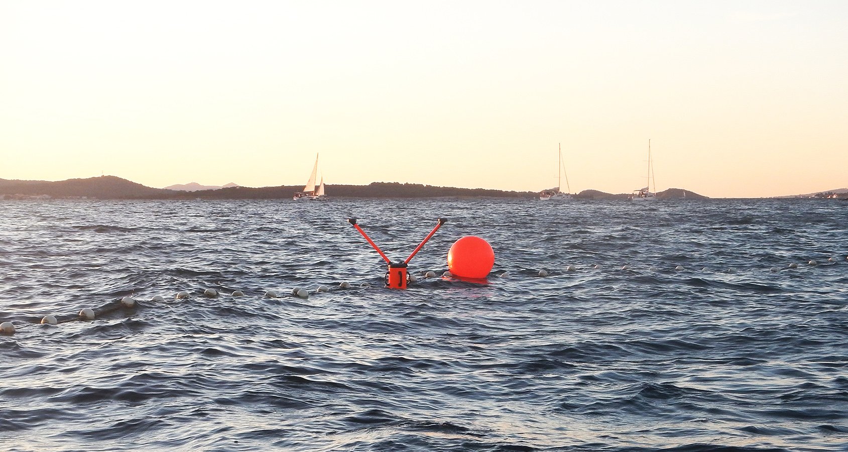
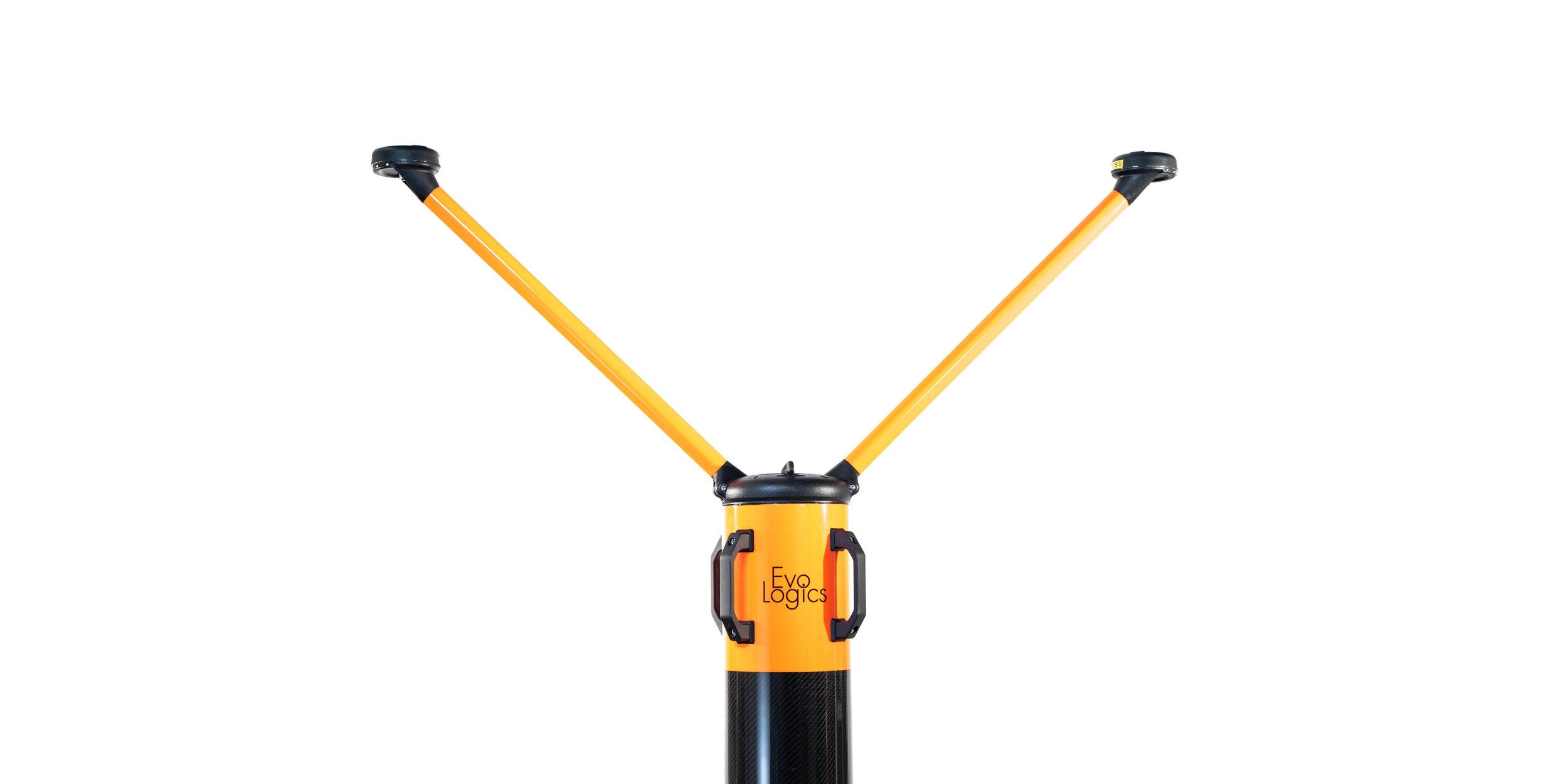

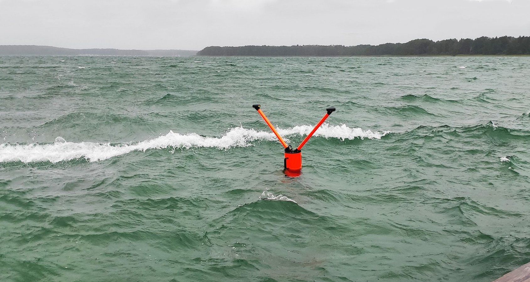


The design concept
The design concept of the system derives from fishing floats that remain highly stable even in rough seas thanks to their long stems and minimal cross-section near the surface. This allows the elongated buoy to remain stable in harsh conditions, and when deployed close to a vessel hull or pier walls, where the waves are taller.
The buoyant body of the unit is made of carbon and glass fiber composites, making it lighter, more compact and robust than conventional designs with foam-based floatation collars.
Stable design concept
How it works
The integrated system eliminates the need to use external GNSS receivers for geo-referenced positioning of underwater targets. Dual GNSS antennas provide accurate yaw measurements without being affected by magnetic interferences. The optional RTK increases precision and accuracy. Moreover, as both sensors are part of the same hardware assembly, it is not necessary to calibrate the relative position of the USBL and the GNSS receiver.
The on-board PC runs the pre-installed SiNAPS, EvoLogics positioning software. The user can access USBL positioning data by connecting to the Wi-Fi access point of the buoy and opening the web-based SiNAPS interface. SiNAPS allows to operate the system and visualize the location of the buoy and target transponders. Furthermore, positioning data can be streamed as NMEA strings and input into other applications that can process this information in real-time.

NETWORK INFRASTRUCTURE
1. COASTGUARD COMMAND CENTER:
Mission control center which connects to all system modules, merges sensor data, communication, and positioning information in real-time. The Command Center recognizes and tracks objects, triggers alarms and provides relevant information on a central dashboard.
2. SEAFLOOR NODE, UNDERWATER NETWORK:
Acts as a node for an underwater
data network, provides USBL and LBL
positioning for moving underwater
objects, supports advanced network
protocols with more than 200 nodes,
will know its own absolute position once geo-referenced
3 MOBILE SURFACE NODE (BUOY):
Acts as a surface-based node for an
underwater network, provides high-precision geo-referenced positioning for the underwater nodes, can create an own mobile network or flexibly extend an existing network
ADVANCED SENSORS
4. SENSOR NODE WITH OBJECT RECOGNITION AND ANALYTICS:
Recognizes and identifies objects of interest through sonar scans, video images, and passive sound profiling, categorizes objects based on neuronal network, identifies main object properties
5. ACOUSTIC SENSOR BUOY (USBL, HYDROPHONE)
Scans and recognizes sound profiles in passive listening mode including direction tracking, can actively ping and track objects in free water in active mode, multiple buoys can create a cross-referenced sensor network
6. SUPPORTED THIRD PARTY DEVICES
The system allows for flexible integration of proprietary sensors and/or third-party devices and vehicles. Sensors that deliver raw data can be enhanced by add-on A.I. modules that will provide object recognition and sensor fusion capabilities.
TARGET INSPECTION
7. SONOBOT 5 USV
Surface-based vehicle, patrols known and/or unknown shallow water areas, provides hydrography, provides A.I. based object recognition, can support underwater operations through surface-based inspection and mobile underwater data and positioning network
8. QUADROIN AUV
Autonomous underwater vehicle,
provides detailed sonar scans and video images of any object of interest, fully network capable to navigate in underwater data and positioning network, collision avoidance features included
9. UNDERWATER DOCKING STATION
Permanent underwater station that acts as a garage for resident AUVs. Underwater vehicles can access the
station, recharge, communicate via cable-based data transfer and wait for the next mission.
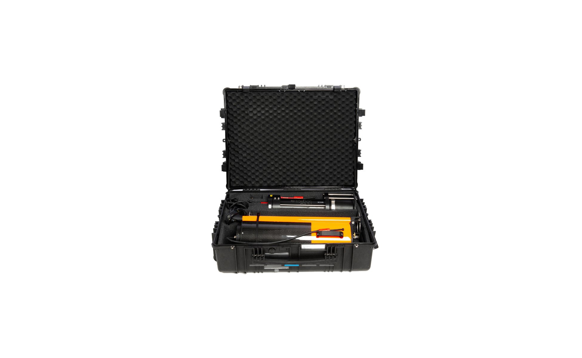
The system packs up into a single case and can be easily transported, assembled and deployed by a single operator.
TECHNICAL SPECIFICATIONS
| Configuration example | ||
|---|---|---|
| Housing | Delrin | |
| Operating range | up to 3500 m | |
| Acoustic connection | up to 13.9 kbit/s |
| General | ||
|---|---|---|
| Operating range | 1000 - 10 000 m depending on the model* | |
| Frequency | High-, mid- and low-frequency models* | |
| Transducer Beam Pattern | Directional and omnidirectional models* |
| USBL Transceiver | ||
|---|---|---|
| Type | S2C USBL Device | |
| Slant range accuracy | 0.01 m | |
| Bearing resolution | 0.1 degrees | |
| Nominal SNR | 10 dB | |
| Host interface | Ethernet | |
| Integrated AHRS | Integrated xSens MTi 30 |
| Integrated units | ||
|---|---|---|
| GNSS | Dual antenna, GPS, GLONASS, optional RTK or Base-Rover configuration | |
| Radio communication | WiFi 2.4 GHz, dual antenna | |
| On-board PC | Pre-installed SiNAPS Software |
| Power Consumption | ||
|---|---|---|
| Stand-by Mode | 2.5 mW | |
| Listen Mode | 5 - 285 mW | |
| Receive Mode | 0.8 W | |
| Transmit Mode | up to 70 W depending on model* |
| Power Supply | ||
|---|---|---|
| Internal | Internal rechargeable Li-Ion battery, 156 Wh (NiMH optional) | |
| Physical | ||
|---|---|---|
| Dimensions | Total/main body: 1138 x 280 x 2240 mm / Ø 180 mm | Over-/underwater: 690 mm / 1550 mm |
| Weight in air/buoyancy | Delrin | 19 kg/ TBC |
| Buoyancy | Composite carbon and glass fiber body | |
| Assembly | Dismantles into 3 parts, quick-release fasteners |
| Configuration options | ||
|---|---|---|
| Remote station | Direct connection from a PC (up to 50 m) or an optional rugged unit with a powerful WiFi module, antenna, rechargeable battery, Ethernet (up to 200 m range) | |
Possibilities.
The USBL buoy is a fully integrated positioning solution. It comprises a USBL transceiver with a built-in battery, mounted to a floating unit with an on-board PC, GNSS receiver with dual antennas, and a Wi-Fi access point.